
Pinned Tweet

The Best Maps Lie Ahead
I want my favorite material culture to live.
I want people in 2130 to cherish a map made in 2030.
I want to see another Turgot-level map produced before I die (pic related).
In 1910 you could buy a 5-cent rail route pamphlet that looks better than nearly ay. This couldn't be otherwise, considering who makes today’s maps:
• Atlas cartographers: mostly gone, those who remain can’t pick colors (exception: @ClarkGeomatics @BenchmarkMaps ).
• GIS managers: their job is to manage the sewer pipe database and make maps for 8.5x11" PDFs, can’t design or don’t have time.
• Editorial cartographers: under tight deadlines, editors don’t care, art directors don’t know how to shape or commission nice maps (Exception: Laris Karklis, Carl Churchill).
• Government cartographers: almost all GIS managers, the maps just gotta reflect the database, nobody cares how they look (exception: Anna Eshelman).
• Nonprofit cartographers: too busy with GIS tasks, boss doesn’t care about nice maps.
• Big tech cartographers: Google/Apple’s maps are database outputs, too constrained by people poking at the map to make them look nice (exception: Nat Slaughter).
• Academic/critical cartographers: not rewarded for making nice maps, rewarded for writing recondite PDFs about maps.
• Capital A Artists: too into deconstruction to make a sincere attempt (exception: Ido Michaeli).
• Biz intelligence cartographers: who’s gonna cherish a bunch of hex bins and choropleths?
Everyone likes old maps because olde timey cartographers started with a blank page and built up; the computer inverted this, letting you start with a cluttered page full of someone else's data and toss what you don’t want to show.
So the computer grants insane leverage to mapmakers (drafter, illustrator, scriber, letterer, colorist, engraver used to be separate jobs) but at an aesthetic cost:
1) You have to actively fight your tools to make the map look like you care about how it looks (████ Esri)
2) A good map requires attention over every square inch. This was built into pre-computer maps because a cartographer couldn't make his/her marks without looking over every bit, but now it’s an extra step that no one’s getting paid for, so it's relatively rare.
There are still dozens of excellent cartographers working today, on and off the computer. In my opinion the best contemporary mapmakers are commercial illustrators; they still start with a blank page, they care about gestalt and composition first, and they don't just affirm software's idea of what a map should look like. Cf. the work of @thisismikehall , Rodica Prato, Neil Gower, Kevin Sheehan, Alex Hotchin.
What is to be done?
Every beautiful map that makes you think "they don't make 'em like they used to": it can be made right now, and better. They had "time, strength, cash, patience," but while attenuated, those things are still around. A patron could pay an illustrator to walk around a city for years and draw every building he saw, like the Prévôt des Marchands of Paris did in 1734.
The bad news is there is no living memory of this art, no old hands to teach how the past's rich maps were constructed. We start from scratch. The good news: we know exactly what to aim for. A time and money problem sounds tractable to me.
The best maps of the future, computer-mediated or otherwise, will require 1) people who care enough to make them and 2) close-range instruction.
Unfortunately there’s no building in the U.S. to combine those two, where the enthusiastic meet the skilled and learn to make beautiful maps. Formal cartographic education does not exist in America; I have a (free) M.S. in cartography and all of the looks-nice mapmaking I did was extracurricular.
Today’s talented anglophone mapmakers taught themselves. The autodidacts are my favorite, but you shouldn't have to bootstrap your own training to make nice maps.
I'm a pro cartographer and I learned the trade by sitting at Daniel Huffman’s elbow and asking 2 years of stupid questions. There's no substitute for sharing a desk with a great cartographer.
This is solved with one building, a few million bucks and ten instructors, i.e. a school with a 1:1 instructor ratio, i.e. map apprenticeships.
Provide a nice space for pro mapmakers to work, students with extant art/design chops pick their mentor do their scut work (shoving around thousands of labels is a rite of passage) and receive a bite of their mentor's project fees. The teacher gets a useful helper and thus can accept more ambitious projects.
If you know a pile of money who wants the future to have great maps, tell them to DM me, I got plans.
Pictured: 1739 Plan de Paris, commissioned by Prévôt des Marchands Michel-Etienne Turgot, an ~8x10 ft. print made from insanely detailed engravings, took six years to complete. Money-fine, enormous, you'd go blind before you counted all those trees someone had to scratch into brass...
I want my favorite material culture to live.
I want people in 2130 to cherish a map made in 2030.
I want to see another Turgot-level map produced before I die (pic related).
In 1910 you could buy a 5-cent rail route pamphlet that looks better than nearly ay. This couldn't be otherwise, considering who makes today’s maps:
• Atlas cartographers: mostly gone, those who remain can’t pick colors (exception: @ClarkGeomatics @BenchmarkMaps ).
• GIS managers: their job is to manage the sewer pipe database and make maps for 8.5x11" PDFs, can’t design or don’t have time.
• Editorial cartographers: under tight deadlines, editors don’t care, art directors don’t know how to shape or commission nice maps (Exception: Laris Karklis, Carl Churchill).
• Government cartographers: almost all GIS managers, the maps just gotta reflect the database, nobody cares how they look (exception: Anna Eshelman).
• Nonprofit cartographers: too busy with GIS tasks, boss doesn’t care about nice maps.
• Big tech cartographers: Google/Apple’s maps are database outputs, too constrained by people poking at the map to make them look nice (exception: Nat Slaughter).
• Academic/critical cartographers: not rewarded for making nice maps, rewarded for writing recondite PDFs about maps.
• Capital A Artists: too into deconstruction to make a sincere attempt (exception: Ido Michaeli).
• Biz intelligence cartographers: who’s gonna cherish a bunch of hex bins and choropleths?
Everyone likes old maps because olde timey cartographers started with a blank page and built up; the computer inverted this, letting you start with a cluttered page full of someone else's data and toss what you don’t want to show.
So the computer grants insane leverage to mapmakers (drafter, illustrator, scriber, letterer, colorist, engraver used to be separate jobs) but at an aesthetic cost:
1) You have to actively fight your tools to make the map look like you care about how it looks (████ Esri)
2) A good map requires attention over every square inch. This was built into pre-computer maps because a cartographer couldn't make his/her marks without looking over every bit, but now it’s an extra step that no one’s getting paid for, so it's relatively rare.
There are still dozens of excellent cartographers working today, on and off the computer. In my opinion the best contemporary mapmakers are commercial illustrators; they still start with a blank page, they care about gestalt and composition first, and they don't just affirm software's idea of what a map should look like. Cf. the work of @thisismikehall , Rodica Prato, Neil Gower, Kevin Sheehan, Alex Hotchin.
What is to be done?
Every beautiful map that makes you think "they don't make 'em like they used to": it can be made right now, and better. They had "time, strength, cash, patience," but while attenuated, those things are still around. A patron could pay an illustrator to walk around a city for years and draw every building he saw, like the Prévôt des Marchands of Paris did in 1734.
The bad news is there is no living memory of this art, no old hands to teach how the past's rich maps were constructed. We start from scratch. The good news: we know exactly what to aim for. A time and money problem sounds tractable to me.
The best maps of the future, computer-mediated or otherwise, will require 1) people who care enough to make them and 2) close-range instruction.
Unfortunately there’s no building in the U.S. to combine those two, where the enthusiastic meet the skilled and learn to make beautiful maps. Formal cartographic education does not exist in America; I have a (free) M.S. in cartography and all of the looks-nice mapmaking I did was extracurricular.
Today’s talented anglophone mapmakers taught themselves. The autodidacts are my favorite, but you shouldn't have to bootstrap your own training to make nice maps.
I'm a pro cartographer and I learned the trade by sitting at Daniel Huffman’s elbow and asking 2 years of stupid questions. There's no substitute for sharing a desk with a great cartographer.
This is solved with one building, a few million bucks and ten instructors, i.e. a school with a 1:1 instructor ratio, i.e. map apprenticeships.
Provide a nice space for pro mapmakers to work, students with extant art/design chops pick their mentor do their scut work (shoving around thousands of labels is a rite of passage) and receive a bite of their mentor's project fees. The teacher gets a useful helper and thus can accept more ambitious projects.
If you know a pile of money who wants the future to have great maps, tell them to DM me, I got plans.
Pictured: 1739 Plan de Paris, commissioned by Prévôt des Marchands Michel-Etienne Turgot, an ~8x10 ft. print made from insanely detailed engravings, took six years to complete. Money-fine, enormous, you'd go blind before you counted all those trees someone had to scratch into brass...
16
45
595
60,323
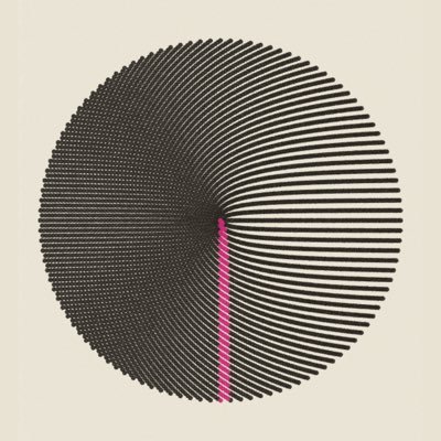
Best known for planting that wheat field in Manhattan, Agnes Denes made a lot of novel map projections, in her words "...working with a paradox, defining the elusive, visualizing the invisible, communicating the incommunicable..."


Agnes Denes, Isometric Systems in Isotropic Space. Map Projections: The Snail. 1974.
Ink printed on synthetic polymer sheet overlaid on graph paper, with charcoal.

1
0
1
79


Excited to grave-rob these for web design
Architectural structures — stairs, pagodas, pavilions, and bridges — seem enchanted, hovering in air or perching improbably on frothy foliage, in Jean-Baptiste Pillement’s designs for “New Suite of Chinese Arabesques”, etched by his wife, Anne Allen: publicdomainreview.org/collection/chi…


3
3
207
5,655
I'm not being arch. I haven’t seen any 2D design made in my lifetime that tops this. Lazy, thoughtless pastiche of old timey doodads slapped onto modern computer stuff is 100000% better than any "original" design made in the last 40 years
x.com/youwillmakemap…
x.com/youwillmakemap…
My design style is "grave robber," how'm I supposed to do better than 1890s type specimen books


0
0
6
139
Q4 2026 software toolkit for selling maps, general designs for print, decks, web, merch. Also big glowing maps of sublime effulgence
◦ Claude Code, Ultra sub, native apps for OSX/iOS/Windows on VMware Fusion. Opus 5.5 on "Extra" seems to have everything in hand
◦ VSCode + Zoo Code + deepseek/GLM/Qwen for banal stuff Claude refuses (stealing mp3s off youtube)
◦ Scrawl by @kitlangton for quickly telling the LLM what to fix scrawl.kitlangton.com
◦ @EduardShading for generating shaded relief from DEMs
◦ Personal rickety ffmpeg localhost fronted for light video editing github.com/evanapplegate/…
◦ Personal rickety "gimme 6x Gemini/GPT Image generations at once" localhost app (I think real image gen heads use Flora or something?) github.com/evanapplegate/…
◦ QGIS for previewing imagery, other map data. Good plugins: Relief Visualization Toolbox, NextGIS QuickMapServices, MetaSearch Catalog Client
◦ Photoshop, Illustrator, InDesign because I'm too old to learn the non-subscription/cloned ones
◦ MAPublisher plugin for Illustrator for real big print maps, I think you have to sub to Global Mapper with an Advanced/Professional plan to get it now
◦ Notion for notes
◦ Claude Code, Ultra sub, native apps for OSX/iOS/Windows on VMware Fusion. Opus 5.5 on "Extra" seems to have everything in hand
◦ VSCode + Zoo Code + deepseek/GLM/Qwen for banal stuff Claude refuses (stealing mp3s off youtube)
◦ Scrawl by @kitlangton for quickly telling the LLM what to fix scrawl.kitlangton.com
◦ @EduardShading for generating shaded relief from DEMs
◦ Personal rickety ffmpeg localhost fronted for light video editing github.com/evanapplegate/…
◦ Personal rickety "gimme 6x Gemini/GPT Image generations at once" localhost app (I think real image gen heads use Flora or something?) github.com/evanapplegate/…
◦ QGIS for previewing imagery, other map data. Good plugins: Relief Visualization Toolbox, NextGIS QuickMapServices, MetaSearch Catalog Client
◦ Photoshop, Illustrator, InDesign because I'm too old to learn the non-subscription/cloned ones
◦ MAPublisher plugin for Illustrator for real big print maps, I think you have to sub to Global Mapper with an Advanced/Professional plan to get it now
◦ Notion for notes
2
0
6
474


Say something nice about Optima right now
11月8日は、ドイツの書体デザイナー #ヘルマンツァップ の誕生日です。
1950年代にデザインされた「Optima(オプティマ)」は、ちょっと不思議な書体です。
マン体の優美さとサンセリフ体のモダンな印象をあわせ持ち、「セリフレス・ローマン」ともいわれています。
一文字ずつ眺めても美しいのですが、文章を組んでみると、Optimaならではの美しさがいっそう際立ちます。
#印刷博物館 #printingmuseumtokyo


6
0
39
1,430
You'll see a pattern
evanapplegate.com
radiantmaps.co
themapconsultancy.com
goods.evanapplegate.com
veryexpensivemaps.com
evanapplegate.com
radiantmaps.co
themapconsultancy.com
goods.evanapplegate.com
veryexpensivemaps.com
0
0
3
175


Thinking about Karen Wynn Fonstad’s “Atlas of Middle-Earth”
There are many fantasy mapmakers, but few fantasy atlas-makers: Oshkosh cartographer Karen Wynn Fonstad’s “Atlas of Middle-Earth” was praised by Tolkien and her maps were used as a reference for Peter Jackson’s films.
Excellent geomorphology and lettering; she passed in 2005.


0
0
10
471
Evan Applegate retweeted

Isometric Los Angeles is now open 🌴
Explore a pixel-by-pixel recreation of the City of Angels, from the Valley all the way down to the Port of LA
isometric.la
Explore a pixel-by-pixel recreation of the City of Angels, from the Valley all the way down to the Port of LA
isometric.la
14
14
120
17,095


Evan Applegate retweeted

Long Dog Samplersさんの「Death by Cross Stitch」が完成しました!
2025年10月6日〜2026年11月1日。
363w×447h、DMC500番(深緑)の1色刺し。
お気に入りはパヤ毛の生えてるキウイさん。2匹いるんだけど、どっちの子も可愛い🩷
#longdogsamplers
#クロスステッチ
2025年10月6日〜2026年11月1日。
363w×447h、DMC500番(深緑)の1色刺し。
お気に入りはパヤ毛の生えてるキウイさん。2匹いるんだけど、どっちの子も可愛い🩷
#longdogsamplers
#クロスステッチ


4
3
91
1,141
@_baldtires It’s a ….map in the forest?

1
0
3
270